Last Updated on December 10, 2025
Old aerial photos can help you uncover the history of your property – its past uses, locations of past structures, original building footprints, etc. If you are curious about how your property looked before you bought it, here’s 4 easy places to find historical aerial photos of your home, tested by yours truly.
Short History of Historical Aerial Photos
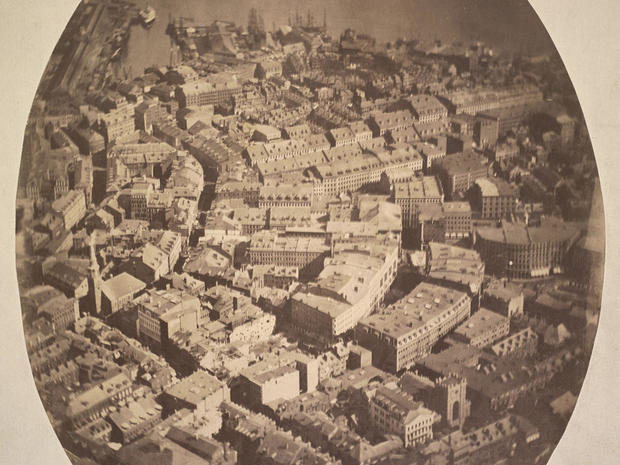
The very first known historic aerial imagery was taken from up in a hot air balloon in France in 1858. About 50 years later, the first aerial photo taken from an actual airplane was taken by Wilbur Wright while working in Italy.
During World War I, aerial photography of battle fields became an integral part of military strategy. After the end of the war, entrepreneurs saw an opportunity for aerial photography for non-military uses. For example, Sherman Fairchild took a series of overlapping photographs of Manhattan that became incredibly popular, kicking off a lucrative photography business.
For more info, check out these interesting articles on the history of aerial photography by the Professional Aerial Photographers Association (PAPA) and Time Magazine.
Historical Aerials vs Old Photographs
Historic aerials are slightly different than old photographs in that they are taken from overhead. An old aerial photo usually include several acres of land in each photo. This provides a clear visual story of how your street, neighborhood, and town was developed over the years.
Since they are shot from a distance, they usually don’t give as much detail as those taken from the ground. But these “birds-eye” photos can still be incredibly useful to uncovering your home’s history and its historical context in your community.
Historical aerial imagery captures building footprints, rooflines, and vegetation. Aerial images can show your original footprint of your home before additions and renovations. Or potentially other structures that have since been demolished, like sheds, barns (and even outhouses).
If interested in exploring ways to find traditional old photos of your house, check out 12 Free Places to Find Old Photos of Your Home.

4 Places to Find Historical Aerial Photos of Your Home
Below are collections with digital images of old aerials online that I personally found to be the best places for the general public. These online historical aerial depositories have photos from blocks of different years.
This post is merely an overview of the historical aerial photographs and satellite imagery available to the general public. For further instruction, clink on the link to each company’s official website. Note that these are not affiliate links – I do not receive any income. This blog post is merely one homeowner sharing information to another.
Before we dive in, I want to point out that I focused on aerial photography collections with digital images for United States. So if you happen to be from a different country, not all of this is not the post for you. Sorry!
1. Vintage Aerial
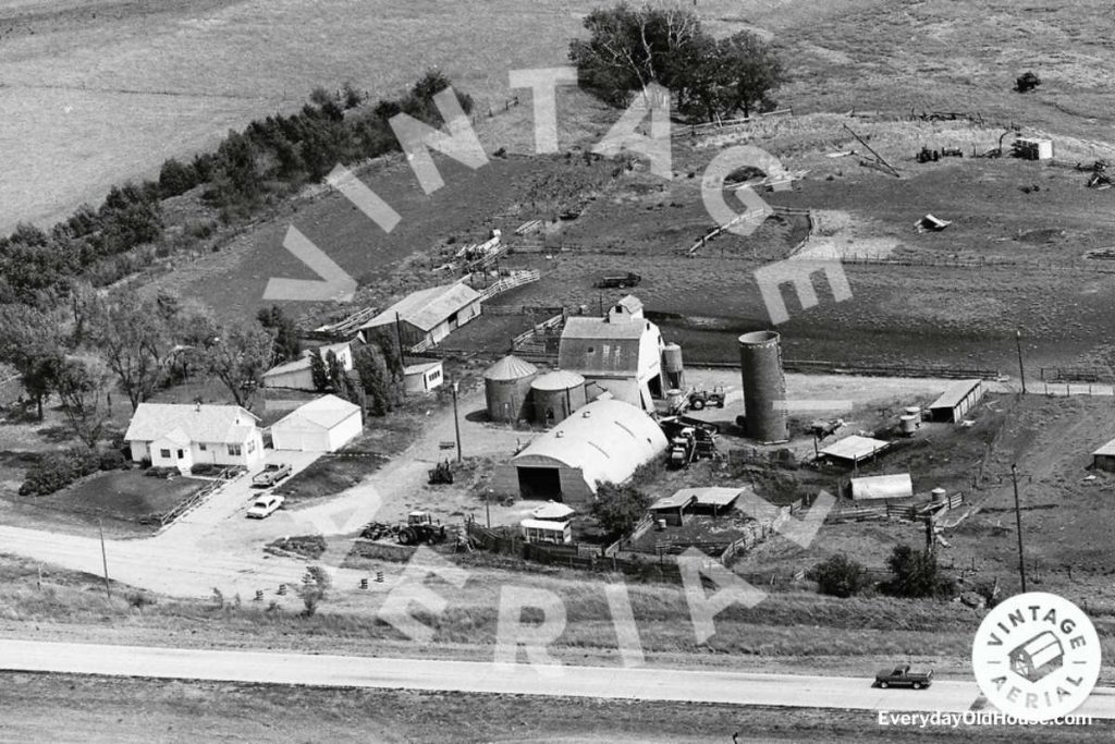
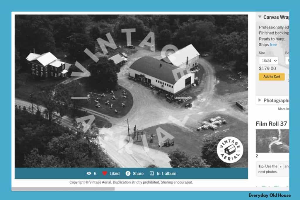
Vintage Aerial focuses on historical aerials of different years for rural communities and small farms. The company is a small 8-person crew with widely varying backgrounds who share a passion for preserving the heritage of rural America – its images, stores and legacies.
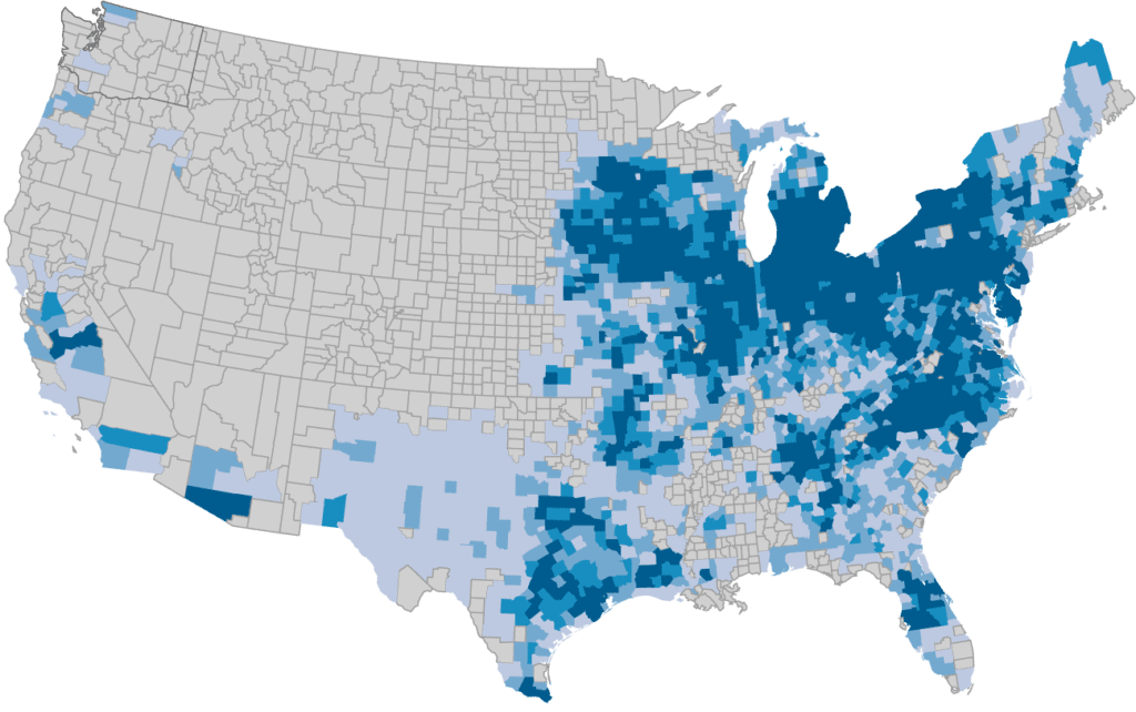
Their official website hosts an aerial photography collection of over 18 million photographs in 41 states from the 1960s onward (see coverage map below).
The majority of the aerial images (if not all) are from the State Aerial Farm Statistics Company, founded and run by Gale Astles. For nearly fifty years, he operated the company, believed to be the largest company of its kind in the world, and he created an aerial visual record of rural America.
Gale documented a time in American history when life revolved around rural communities and small farms. So if you live in an urban area like myself, you probably won’t find any historical imagery of your area of interest. BUT I would still give the site a shot – the old aerial photos here are remarkable. As you can see from this Georgetown University professor’s search, homeowners can develop a visual timeline of their property’s history.
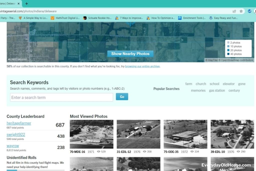
Searching for an address was slightly more difficult than other historical aerial databases and required more information. HOWEVER, the extra effort was definitely worth it. The images were closer and taken from a more oblique angle than others, providing more detail of the homes and other structures on the farms.
Vintage Aerial has the unique option of researchers being able to add comments as well as tag photos. This capability fosters a sense of community amongst folks who research aerial photographs, yet another reason to research the history of your home! You never know who you might bump into or find during your research!
The search part on Vintage Aerial took a bit to get used to, BUT once I got into a groove, it was easy. And SUCCESS!!! I found my father-in-law’s childhood home in upstate NY – it was a John Deere dealership for many years.
If you want to dive deeper into how to search on Vintage Aerials, here’s my YouTube tutorial.
2. Historical Aerials
Historic Aerials gives you access to the largest aerial photography collection in the United States (presumably the same database as USGS EarthExplorer) with decades of data. Often you will find historical aerials from each decade beginning in the 1930s through the 2000s. That’s over 70 years of old aerial photos!
The search feature claims amazing high-quality accuracy to help you pinpoint the location of your home fairly easily and by aerial year. And I found that to be true. The program was easy and fast to use, with great accuracy in finding your current location.
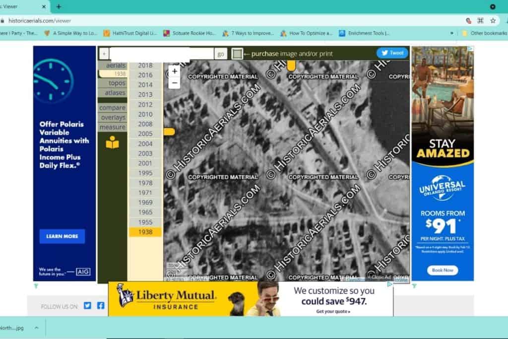
Historic Aerial’s website is free to browse to find your home or area of interest online. In addition to aerial images, this is a good place to also review topographic maps. However, you must purchase high resolution images to remove watermarks.
Want to dive deeper? Here’s a YouTube tutorial by yours truly….
3. Google Earth Pro
Google Earth Pro allows you travel back in time with their database of historic aerial satellite imagery. Google does it all, doesn’t it!
[Note that Google Maps nor Google Earth have an option for historic imagery. You specifically need to download Google Earth Pro. This version is available only on desktop for PC, Mac and Linux.]
Once you have downloaded the program, this video (albeit dated) does provide a perfect tutorial on how to access historic digital files, index maps, and how to navigate the map layer by aerial year.
I downloaded Google Earth Pro and found it useful, but not as comprehensive as Historic Aerials for my geographical area (Boston). It was extremely easy to find an address, but the older aerials were slow to upload (or at least is was on my desktop). The printout of a selected area was clear and easy to do.
BUT it’s free, so I can’t complain!
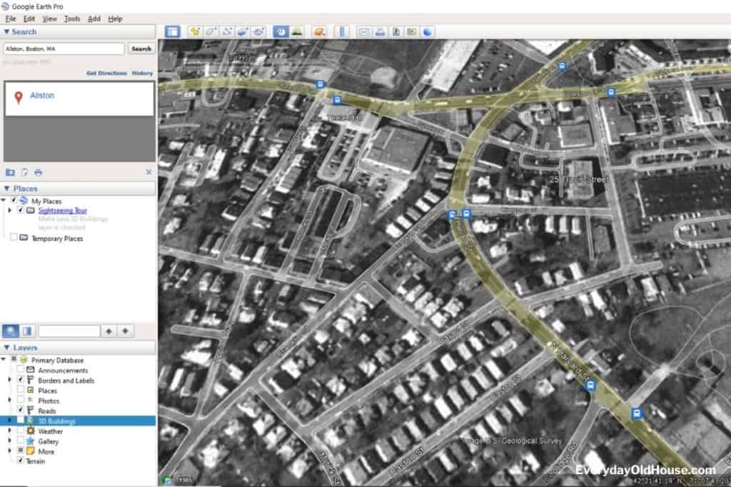
Note that the aerials for my geographical area weren’t overly old. They only went back to 1985, which I was surprised since I live in a major metropolitan area.
But the YouTube video indicates that some areas (like Las Vegas) go back to the 1950s. So depending on your geographical area of interest, this historical imagery resources has great potential to find older historical aerial photos of your home.
BEGINNER’S GUIDE TO HOME HISTORY RESEARCH
Interested in researching the history of your old house but unsure where to start? Grab my newly-release:
Beginner’s Guide: How to Trace the History of Your Old House
This 60-page guide takes you step-by-step through 25+ online and in-person resources to create a picture of your home’s history.

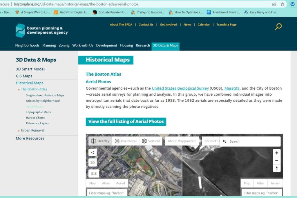
4. State & City Aerial Archives
Still can’t find historic satellite images of your area? Many municipalities have their own Geographic Information System (GIS) Programs that include historical aerial imagery to help support maintenance and development. A quick search online found comprehensive historical aerial databases on gov websites for states like Pennsylvania and cities like Boston and Aspen.
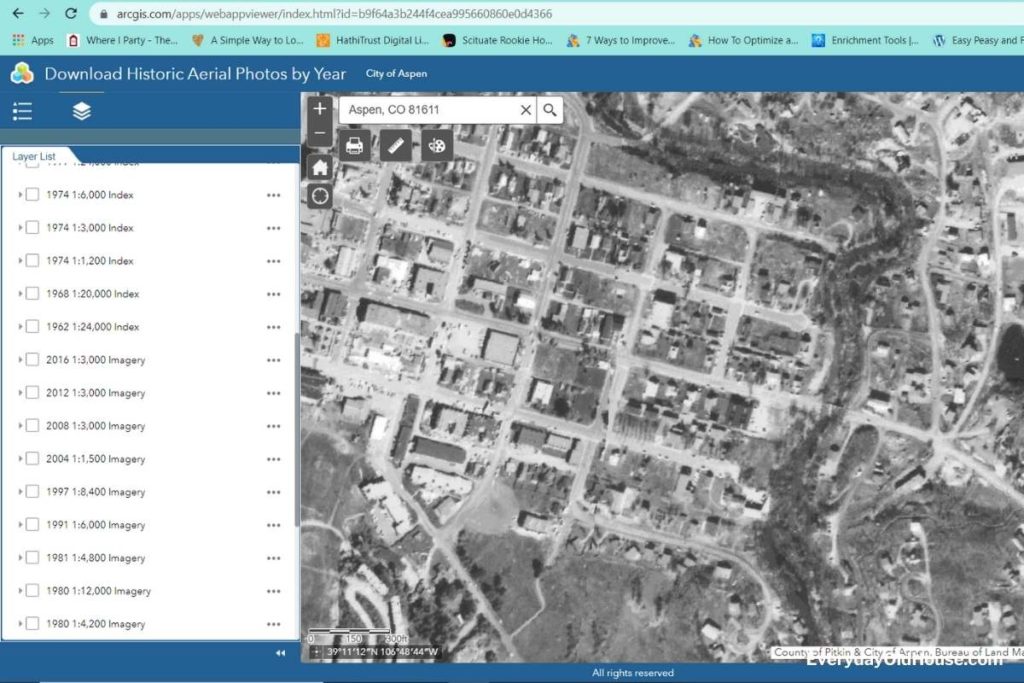
Some aerial maps available here were originally photographed by federal agencies, like the United States Geological Survey (USGS), or United States Department of Agriculture (USDA). But in the second half of the 20th century it was common for state and city agencies to initiate their own series of aerial photographs to support development projects.
The best way to find these historical aerial resources is reach out to your local or state library archives, or even your state college.
Here’s links to various historic aerial databases on gov websites I’ve found to date for various states. If you find a link to your state and it’s not below, please email me the link and I’ll add it.
Other Resources
There are many other aerial photo online depositories online, such as the ones below. However, I didn’t find them either as useful or, quite frankly, the “easiest” to use. For example:
- WayBackLiving: The detail on the aerials are amazing, but the database only goes back to 2014.
- Aerial Photography Field Office (APFO): This division within the United States Department of Agriculture (USDA) is home to one of the country’s largest aerial film libraries, but I couldn’t find a way to actually pull up the historical images.
- United States Geological Service (USGS): I struggled with finding historical satellite images on this gov website EarthExplorer program. Perhaps you will have better luck.
Disclaimer
I am not a professional home genealogist (nor play one on tv….). However, as a environmental consultant for 10+ years, I researched the history of 100+ commercial properties for property owners, potential buyers, and real estate developers. I utilized a variety of historical databases and resources – historical maps, government databases, interviews, and property visual clues – to create a picture of a property’s past.
My mission is to use these consulting skills (combined with genealogy classes) to help other homeowners to research the history of houses.
Note that my experience is limited to the United States. For European homes, I suggest this website.
Related Posts


Want to be the first to know about new posts? Be sure to follow me on Pinterest, Facebook, Instagram or Twitter of even Etsy! Or better yet… Subscribe below!
My monthly (admittedly sometimes more, sometimes less….) emails are like receiving a unexpected letter from an old friend WITHOUT needing to put on your slippers and walk out to your mailbox…. See? I got ya, my friend!)
[Note: My posts are proudly connected to these amazing link parties full of DIY ideas and inspiration!]