Last Updated on October 4, 2025
Do you wonder what your home and your town used to look like? Where the first building were constructed as far back as the 18th century or 19th century? Historic maps are the best lace to visually show the evolution of a geographic area over time. Interested in finding early maps of an area but unsure where to start? Check out these 5 (many online and free!) places to find old maps of your town.
BEGINNER’S GUIDE TO HOME HISTORY RESEARCH
Interested in researching the history of your old house but unsure where to start? Grab my newly-release:
Beginner’s Guide: How to Trace the History of Your Old House
This 60-page guide takes you step-by-step through 25+ online and in-person resources to create a picture of your home’s history.

Backstory
In 1996 when I moved to the big city (aka Boston) after graduation, there was no GPS. So my parents bought me a AAA-spiral bound 125+ page road atlas of Eastern Massachusetts.
This map book went everywhere with me. I learned the city streets, shortcuts, back ways, and best parking areas using this book. I inhaled the information in that map book.
Eventually I exchanged my tattered map book for GPS. But I still miss the adventures of using my old map book.
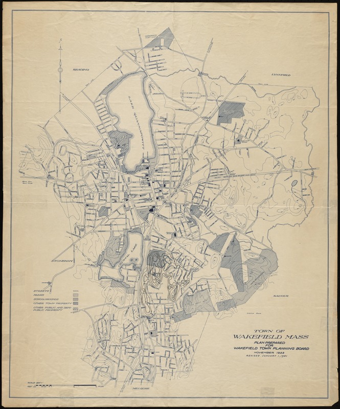
Historic map collections show how land was used over time. Early maps can reveal details like early farm boundaries, construction of schools, churches, cemeteries, and hospitals. Later maps may document the coming of the industrial revolution, when development and expansion really kicked into gear, and the arrival of transportation systems like railroads and major roads.
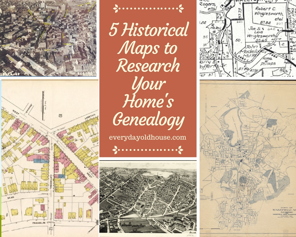
5 Places to Find Old Maps of Your Town
A historical map collection provides a great visual history of your home and surrounding area. Map collections are more prevalent in geographic areas than others. Below are the 5 easiest places to find old maps of your town to help you research your home or town’s history.
Note that the majority of these are available on-line or through local channels such as your local library or historical society. Which make them FREE!! Got to like that, right?
1. Sanborn Fire Insurance Maps
Sanborn Fire Insurance Maps were hand-drawn historical maps made by professional surveyors for insurance companies. These maps were made for insurance companies to assess the fire risk to buildings.
The Sanborn Corporation commercially produced these maps for almost 100 years (from 1866 until the 1960s). They produced over 1.2 million maps of approximately 12,000 American cities and towns. WOW!!! An impressive resource, right?
One of the great things about Sanborn Maps is their level of detail. This map collection is very distinctive due to its sophisticated set of symbols (color coded) that presents A LOT of information very clearly. Sanborn Maps were made to scale and showed detailed information, including:
- Street addresses
- Property boundary
- Building footprint
- Construction material (i.e. wood, stone)
- Construction date
- Building height/ number of floors
- Location of doors and windows
- Occupancy/ site use
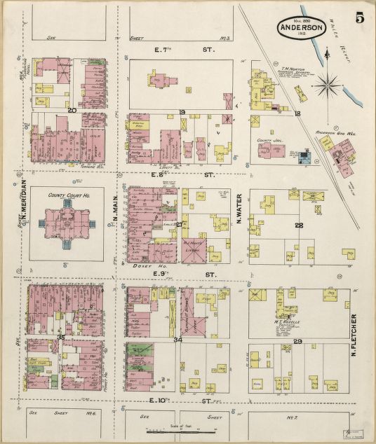
Note that since these maps were meant for commercial/ insurance purposes, the majority are focused on downtown or commercial areas. Sanborn Maps are more city maps. Therefore, if you live in a rural area, it is less likely you will find your home or town on a Sanborn map (check the Topo Maps below).
How to Interpret a Sanborn Map
These historical maps conveyed a significant amount of information through a color-coded system and shorthand of sophisticated symbols. These maps were so accurate and detailed that during World War II there was a concern that the maps would fall into enemy hands. Below are a few legends or “keys”.
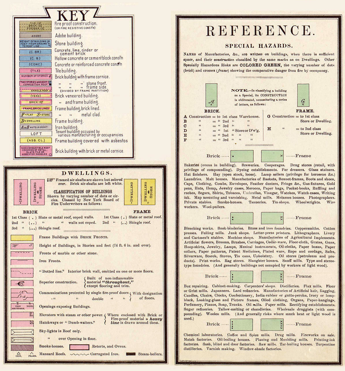
The Library of Congress has a detailed explanation of the key worth reading. The Washington State Department of Archaeology and Historic Preservation provides a good example of how to interpret the key when reviewing a map.
Sanborn Maps are commonly at your local library, historical commission or historical society. If not, check out the federal Library of Congress, state library or your state colleges and universities libraries. Maps can also be purchased from the Sanborn Company directly.
Note that Sanborn wasn’t the only company that made maps for insurance companies, however, Sanborn was the most prominent. Competitors included:
- Baist Real Estate Atlases
- Rascher Maps (specific to Chicago)
- Fire Underwriters Inspections Bureau Maps
2. Panoramic Maps
In late 19th and early 20th centuries, about 1,800 towns and cities in the United States and Canada commissioned hand-drawn panoramic maps. These historical maps were popular during the height of the industrial revolution, viewed as a “patriotic movement” to showcase a municipality’s economy and growth.
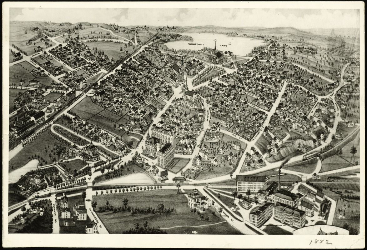
These maps were usually drawn from an oblique angle above the landscape creating a slight 3D illusion. Reportedly, artists would climb nearby hills, trees, or even build platforms to paint this “bird’s-eye-view”. These maps were more portraits of the town, and meant to show off unique characteristics of the municipality and surrounding area.
Features drawn include it a town’s main buildings, major industries, and land features such as lakes, hills, etc. These maps are beautiful artistic renderings, like a town’s “portrait”. And since artists drew these maps (versus surveyors), panoramic maps were usually not drawn to scale, which may lead to some confusion with research.
If you can’t find these maps at your local library or historical society, these are commonly available for purchase through an online catalog as artwork.
3. Topographic Maps
The US Geographical Survey (USGS), a federal government agency, produced topographic maps (commonly “topo” or “contour” maps) starting in the 1880s. And unlike many of these other maps, are still being produced today.
The main intent of topo maps is to show an area’s natural features such as elevation. Contour lines mark elevation changes in terrain (i.e. curves that show the highest and lowest altitude points). In addition, maps showed other significant features, such as:
- Water features, such as lakes, rivers and canals
- Large forested areas
- Swamps and marshes
- State, town, and park (federal and state) boundaries
- Significant man-made features
- Railroads
- Transmission lines
- Mines and caves
If you are looking for building-specific information, topo maps aren’t as telling as other early maps since they focus on land (versus building) features. However, if you are located in a rural area or area with significant natural features (i.e. mountains), these might be a better resource of old maps of your town than Sanborn city maps.
US Topo maps are downloadable for free on the public domain from several USGS websites.
4. Aerial Maps (Photographs)
These old maps differ slightly in that, well, they aren’t truly vintage maps, but actually photographs. Think of these as “Pre-” Google maps. Airplanes (and even hot air balloons!) flew overhead in a grid pattern with photographers capturing shots from overhead.
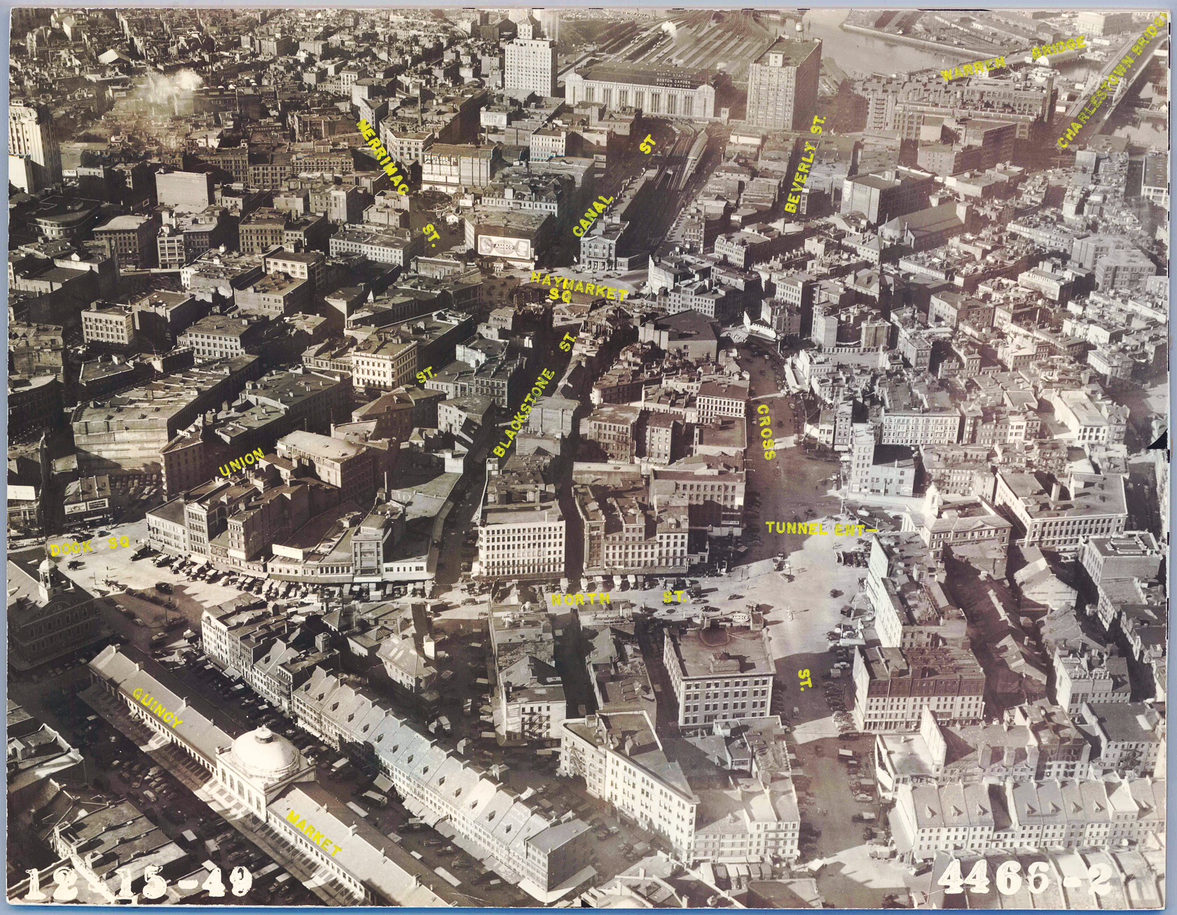
If you can’t find old maps of your town locally, check out 4 Best Places to Find Historic Aerials of Your Home. These online catalogs are free to browse, with some charging a small fee for a physical copy. While you might think that historic aerials were limited to dense urban areas, you might be surprised. One of the places, Vintage Aerial, specifically focuses on rural and farm communities and contains over 18 million photographs in 41 states.
5. Land Ownership Maps
The United States in the 1700-1800s rapidly expanded into the Midwest and to the West Coast. As part of the expansion, the federal government commissioned a variety of exploration surveys to document the division of land to various owners. These ownership maps, also called cadastral maps, outlined individual plots of lands marked with various owner’s names.
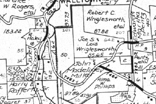
Check with local sources on the best way to proceed, but cadastral maps are available on-line via federal government and commercially, such as:
- Bureau of Land Management
- Library of Congress
- National Archives and Records Administration
- Ancestry.com
Click here and scroll to Resource #7 to learn more about government department and databases for researching home histories.
Disclaimer
I am not a professional home genealogist (nor play one on tv….). However, as a environmental consultant for 10+ years, I researched the history of 100+ commercial properties for property owners, potential buyers, and real estate developers. I utilized a variety of historical databases and resources – historical maps, government databases, interviews, and property visual clues – to create a picture of a property’s past.
My mission is to use these consulting skills (combined with genealogy classes) to help other homeowners to research the history of houses.
Note that my experience is limited to the United States. For European homes, I suggest this website.
Related Posts


Want to be the first to know about new posts? Be sure to follow me on Pinterest, Facebook, Instagram or Twitter of even Etsy! Or better yet… Subscribe below!
My monthly (admittedly sometimes more, sometimes less….) emails are like receiving a unexpected letter from an old friend WITHOUT needing to put on your slippers and walk out to your mailbox…. See? I got ya, my friend!)
[Note: My posts are proudly connected to these amazing link parties full of DIY ideas and inspiration!]